from 2021/4 to 2021/5
- Java
- Android
- Google Maps API
- GPX Serialization
MapMe
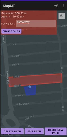
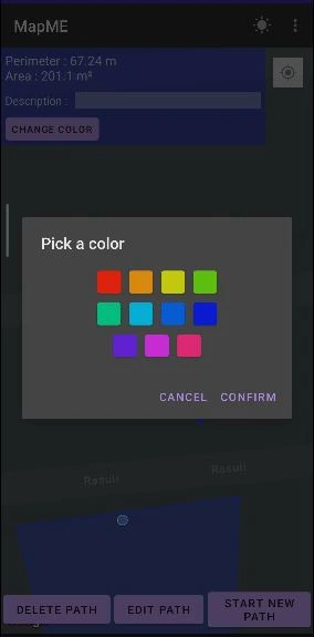
MapMe is a lightweight GIS Android application that helps you create custom maps using your GPS location or manual pin drops. It lets you visualize routes and areas on Google Maps, and performs area and perimeter calculations for open or closed routes.
Ideal for fieldwork, land surveying, outdoor planning, agriculture, or anyone who needs quick geospatial measurements — right from their phone.
Screenshots
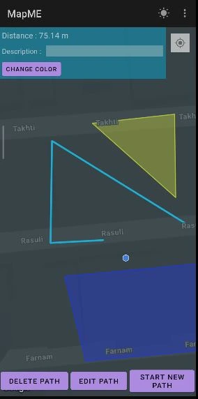
What It Does
- Shows your current location using GPS
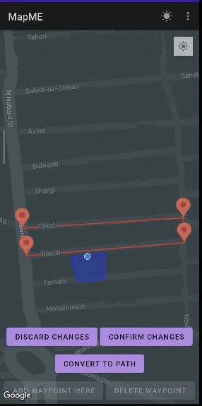
- Lets you drop pins manually or record your path automatically as you move
- Builds a route (open path or closed polygon) from your points
- Calculates:
- Perimeter (distance between all points)
- Area (if the shape is closed)
- Displays the route on an interactive Google Maps view
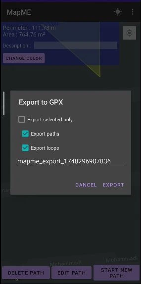
- Exports/imports your routes using GPX format
Tech Stack
| Feature | Stack / Tools |
|---|---|
| Platform | Android |
| Language | Java |
| Maps & Location | Google Maps API, GPS |
| File I/O | GPX format (for export/import) |
| Geometry | Custom algorithms for area/perimeter calculation |
Features
- Real-time map view with Google Maps
- Add location points via GPS or by tapping on the map
- Automatically track your path as you move
- Calculate area (m², hectares, acres) for closed polygons
- Get total distance/perimeter of routes
- Export routes to GPX format for use in other GIS tools
- Import existing GPX files to continue or review work
- Dark/light theme support
- 🆎 Localization (Persian and English)
Example Use Cases
- Field measurement for agriculture or construction
- Estimating land parcel size
- Planning outdoor activities or hiking trails
- Mapping survey points and collecting spatial data
- Educational tool for learning GIS basics on mobile